 MPS
was engaged by Grow
Smart Rhode Island (GSRI) to undertake a
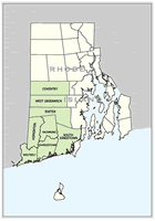
GIS Assessment within the eight town Washington
County region in southern Rhode Island, with
the purpose to build local GIS capacity. This
area is one of the fastest growing regions in
southern New England, as well is part of The
Nature Conservancy’s Pawcatuck Borderlands
landscape – the largest forested system
between Boston and Washington, D.C. GSRI
and the Washington Regional Planning Commission
recognized that GIS is an essential component
in the planning toolbox for sound land use planning,
growth management and land conservation efforts.
MPS
was engaged by Grow
Smart Rhode Island (GSRI) to undertake a
GIS Assessment within the eight town Washington
County region in southern Rhode Island, with
the purpose to build local GIS capacity. This
area is one of the fastest growing regions in
southern New England, as well is part of The
Nature Conservancy’s Pawcatuck Borderlands
landscape – the largest forested system
between Boston and Washington, D.C. GSRI
and the Washington Regional Planning Commission
recognized that GIS is an essential component
in the planning toolbox for sound land use planning,
growth management and land conservation efforts.
The GIS Assessment identified
all existing and planned GIS systems and activities
with the region, both public and private. Local
needs were assessed, stakeholder’s meetings
conducted and recommendations developed. MPS
and other GIS Steering Committee members, highlighted
the need for a local matching program to build
GIS capacity to the RI Governor’s Growth
Council.
The GIS Assessment also
summarized the cost-benefit of developing parcel
data. Today, four of these six towns have developed
(or are in the process of developing) parcel-based
GIS systems. Several of the towns are collaborating
with the objective to share staff and resources,
as well as conducting regional land planning,
storm water management and conservation projects
that take advantage of improved GIS capabilities
at the local level.
The GIS Assessment project
was funded by Doris Duke Charitable Foundation.